
Map engine and API
Route maps, drawn for your app.
Send a GPS route. Get back a finished map card: the terrain, the trails, the climb in profile and the credits, ready to share or print.
No route? Send a place instead, and get the ground on its own: a terrain print, a backdrop, a marker where it happened.
What it draws
A route, or just a place
A GPS route is the main act. A centre and a span, or a box, is enough too: the ground alone, or with markers and a few words.
Shapes and views
Story, portrait, square, landscape or wide, at any size up to print. A flat map, a block of ground, the ground seen at an angle, ridgelines or a ribbon.
Looks
Light and dark, from quiet paper and Swiss relief to bold colour.
Real ground
Terrain from Copernicus GLO-30, around the world. Roads, trails, water and land cover from OpenStreetMap.
Markers
Icons of our own, from pins and flags to summits, water and viewpoints, each with a short label.
Words, fonts and units
A title and subtitle, notes, a date and the coordinates, in the look’s own fonts or a wide choice of open-licence ones. Metric or imperial, or chosen for each kind of number: distance in kilometres, miles or nautical miles, heights in metres or feet, and speeds and temperatures too.
Files you can keep
SVG with its fonts inside and no scripts or outside links. PNG for a screen or for print. A vector PDF, its words still text. The line and markers as GPX.
Simple or full
Ask for the layers you want and nothing more: the ground alone, a route on it, markers and words, or a full card with numbers and a profile. A plain picture is a layout that fits, not a lesser one.
Credits inside
Every picture carries the credits for the data it draws, small and in the margin, so they travel with it.
Examples
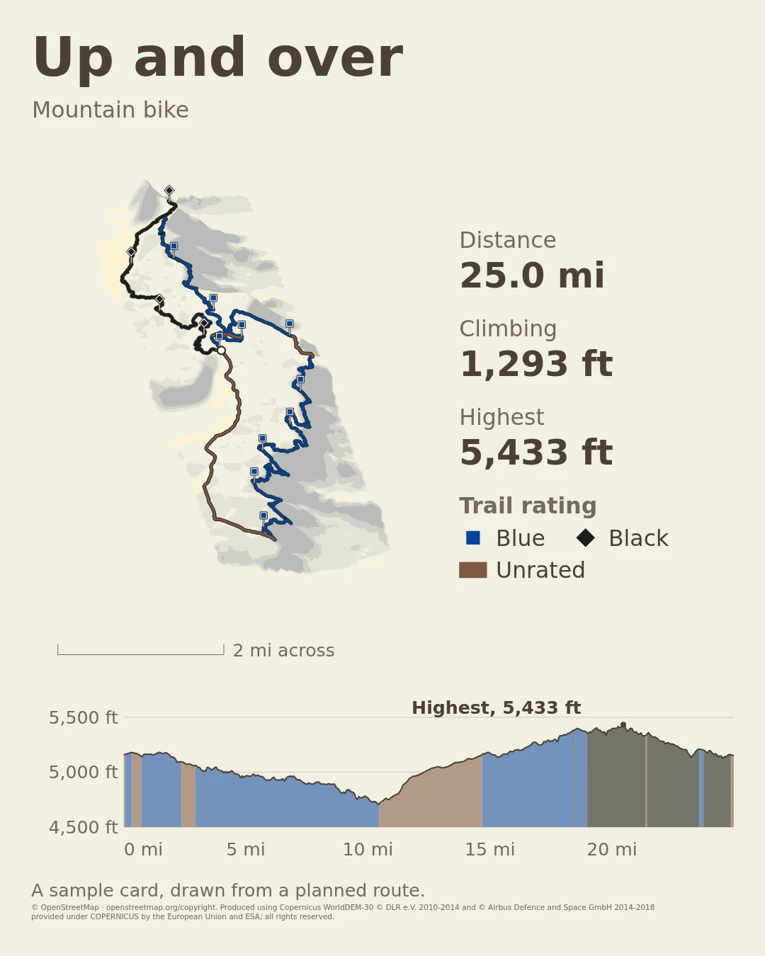
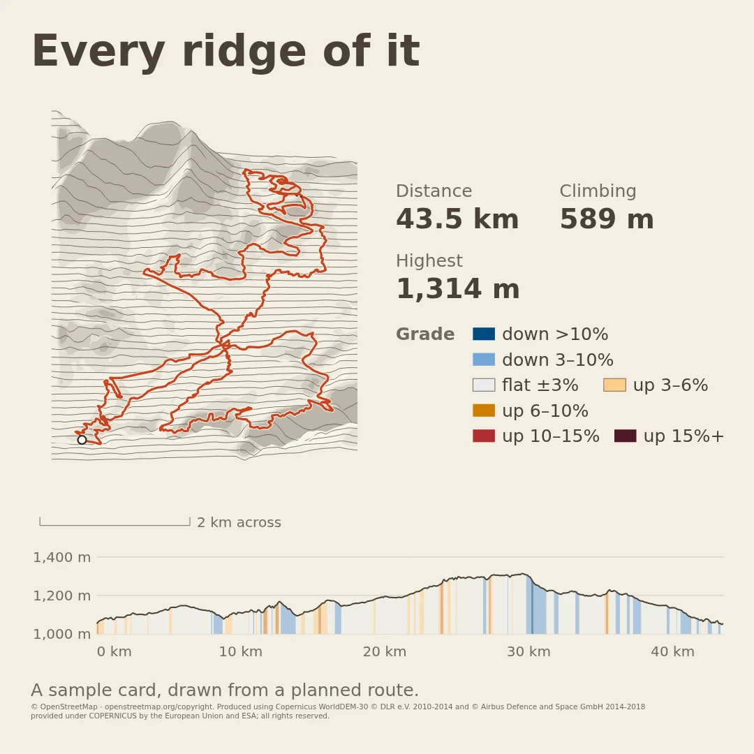
Simple or full, by choice. A picture holds only the layers you ask for, so a quiet one is a choice: the ground alone, one line on the hills, or a whole card with a title, the numbers and the profile. The same route can be any of them; the Alpe d’Huez climb and the Half Dome hike each appear twice.
Each is one call to the API, drawn on 2 November 2026 from public places and courses. Open one to see it full size, credits and all; the arrow keys or a swipe go on to the next.
Simple
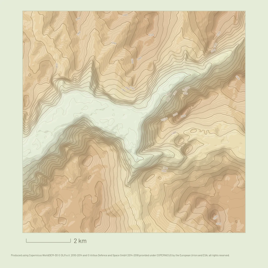
The ground alone, or one line on it. Nothing else to read.
The ground
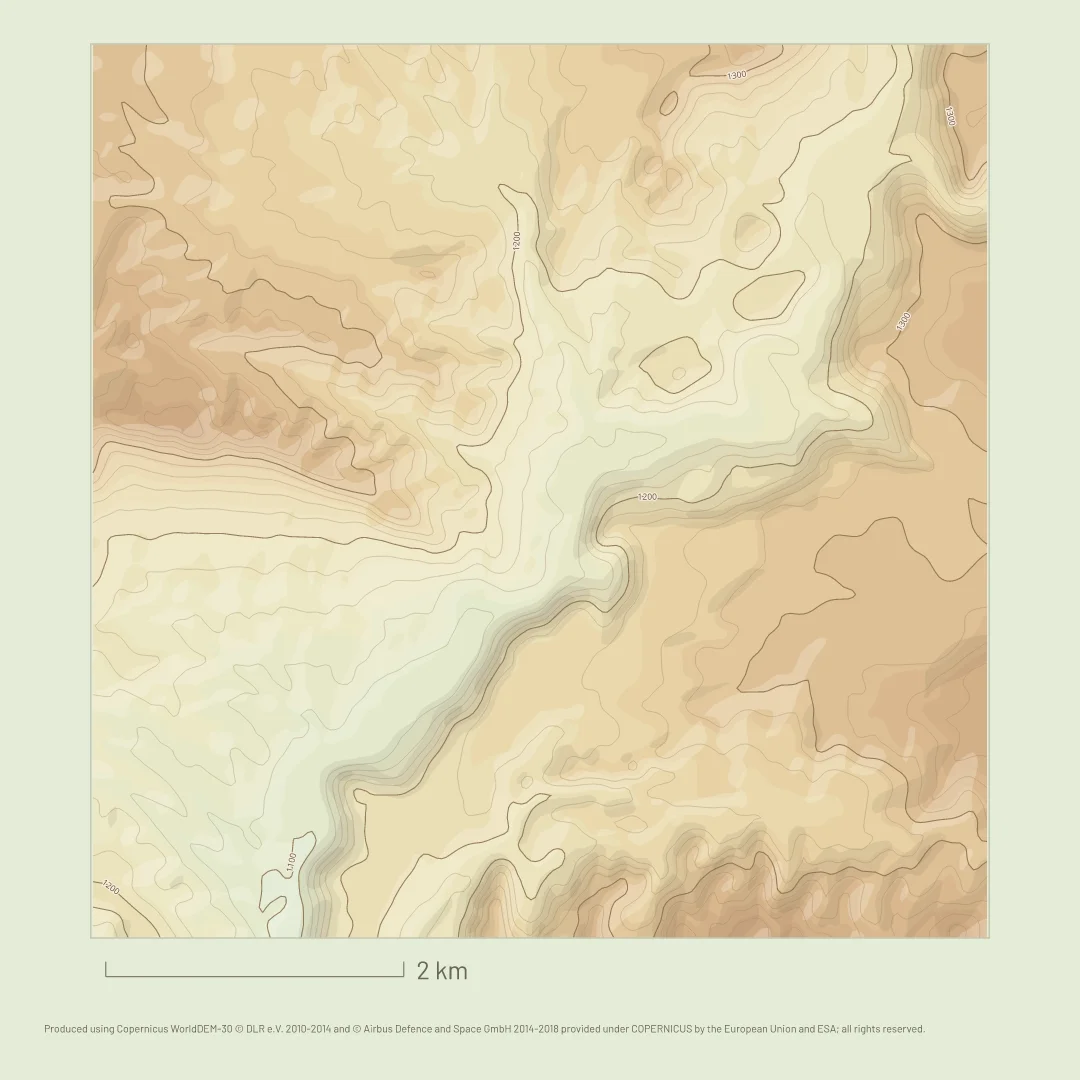
A place on its own
Yosemite Valley in the Hypsometric look: heights in colour, contours and a scale bar. No route and no words.
The ground and a route
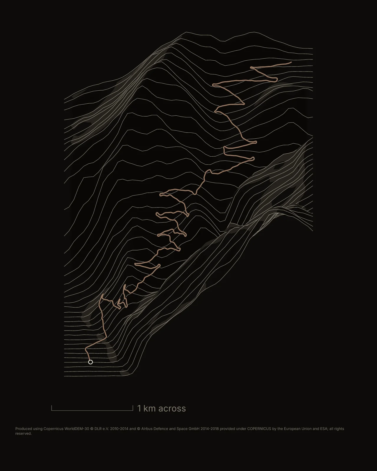
Terrain art
The climb to Alpe d’Huez drawn as ridgelines in the Night chart look, its heights doubled. The shape is left to reymaps, which picks the one the ground fills.
The ground and a route
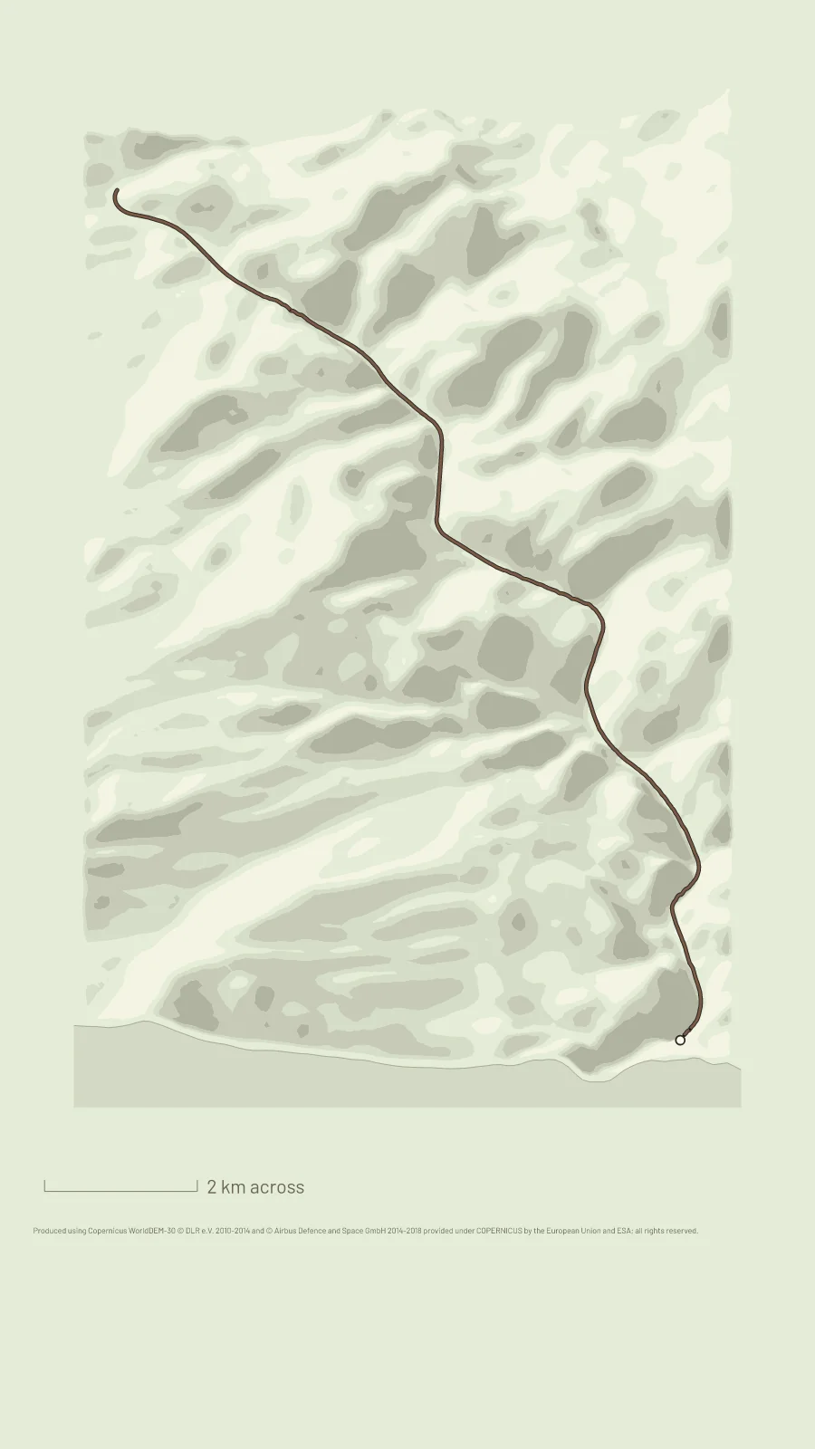
An angled view
A paddle down the Black Canyon of the Colorado, on a block of ground in the Hypsometric look, in the tall shape reymaps chose for it.
In between
Streets and names, markers, a title: as much as the picture needs.
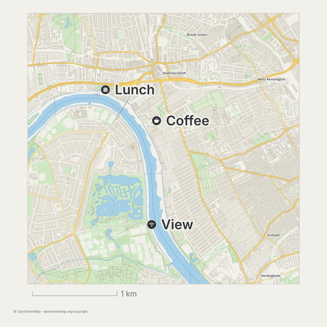
Streets, names and markers
A city guide
London’s streets by the Thames with three pins, Lunch, Coffee and View, in the Streets look. No route, just the place and the markers.
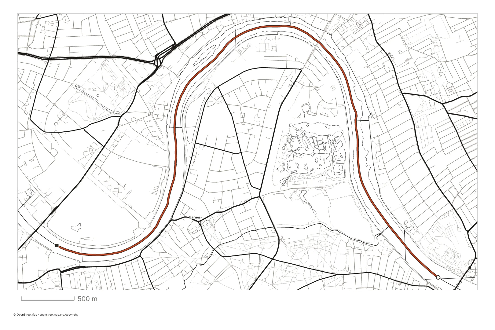
Streets, names and a route
Line art for print
A rowing course on the Thames around Barnes, in the Ink look: black lines on white, the course in red.
Trails, a route, markers and a title
A trail guide
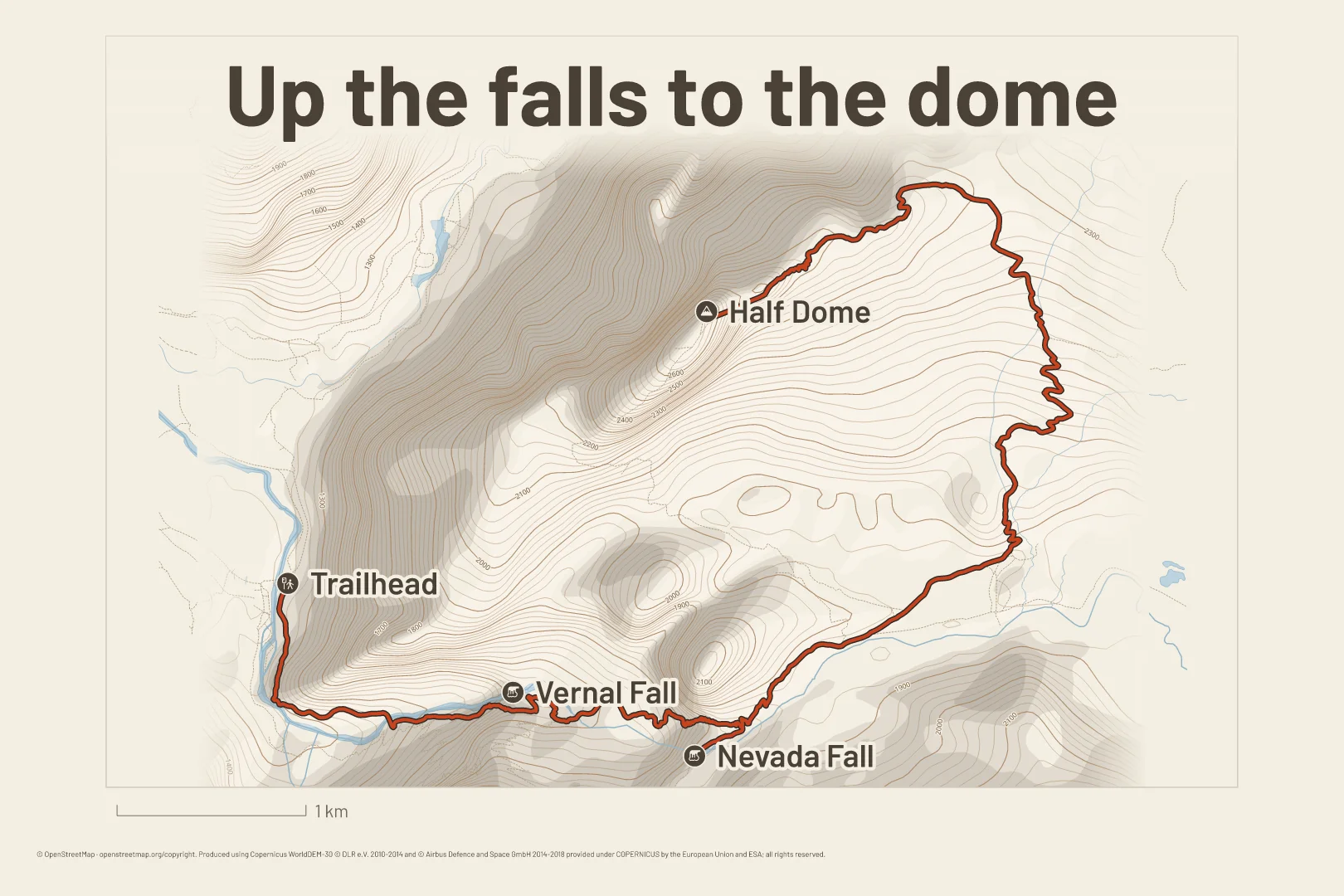
Up past Vernal and Nevada Falls to Half Dome in Yosemite, the falls and the summit marked, on contours and relief in the Outdoors look.
Full
A title, the numbers and the profile, laid out as a card.
The full card
A climb card
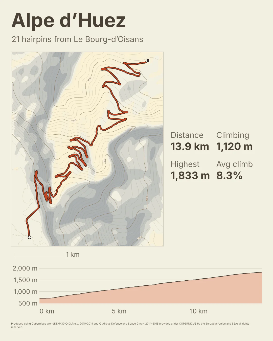
The same climb as the ridgelines above, as a full card in the Swiss relief look: a title and a line under it, four numbers, and the climb in profile.
The full card
A story for a hike
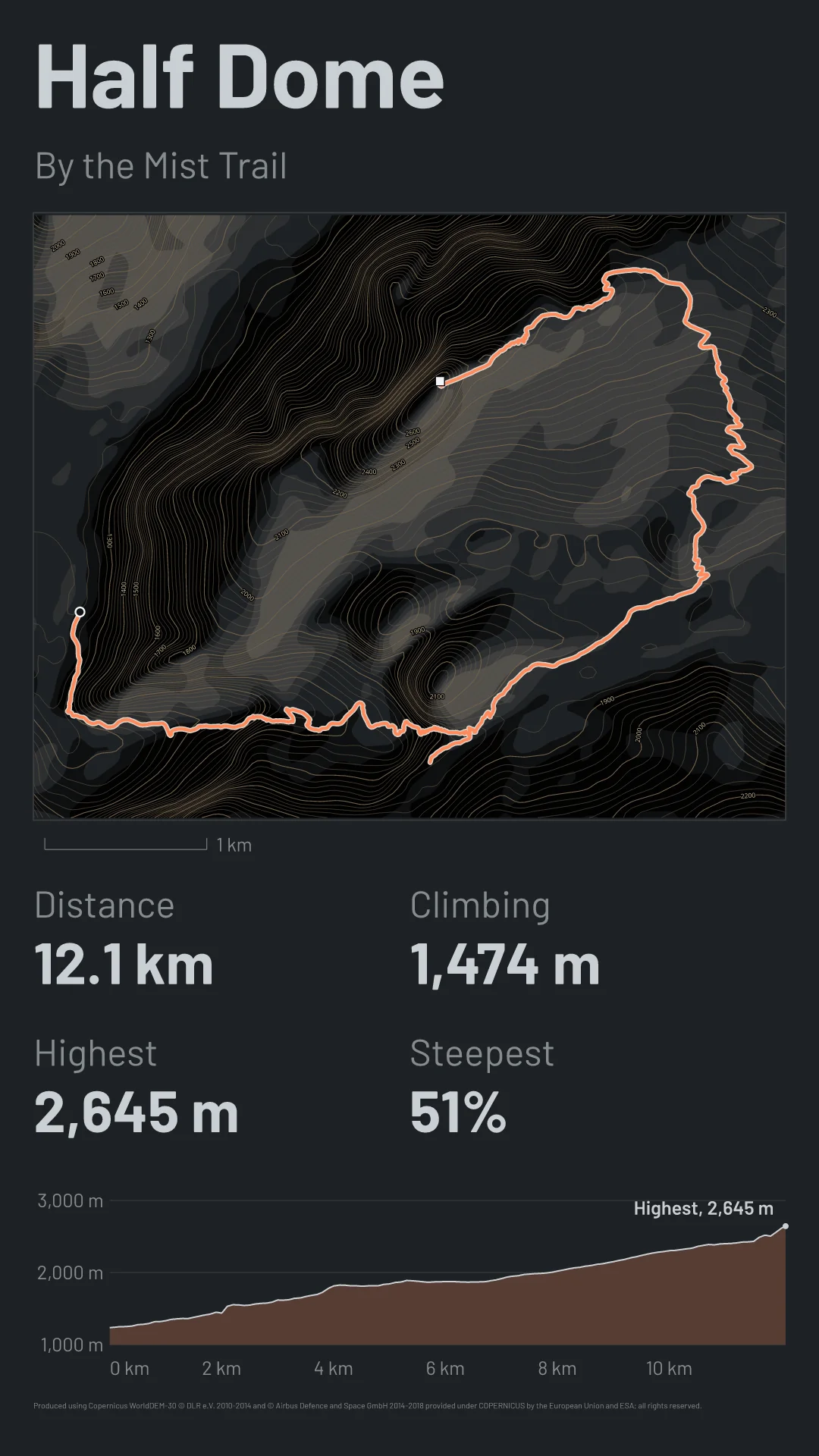
The hike from the trail guide as a full card in the Lit relief look, in the tall Story shape for a phone: the route on relief, four numbers and the climb in profile.
Who it’s for
If you’re an athlete, Treadentials probably has you covered. It’s our own app for turning a run, ride, hike or race into a card, and it makes custom branded cards of an event’s course, sent straight to each athlete.
Otherwise, reymaps does. It’s for software makers whose product needs a route or a place drawn: journals, trail and travel guides, print shops and terrain art. Your users see the picture in your product, and you tell us what you’ll draw with it. Since Treadentials is built on reymaps, the API isn’t for building another app like it.
Early access
The API isn’t open yet. We’re settling its request and its looks first, so the first clients won’t have to change their code later. Plans will be set per client, by how many maps you draw and what you draw. Tell us what you’d make with it, and we’ll write when it opens.